Timisoara Map
Timisoara sits in western Romania, in Timis County in the Banat region, close to both the Hungarian and Serbian borders, and its compact center makes it one of the easiest Romanian cities to map and walk.
Short answer
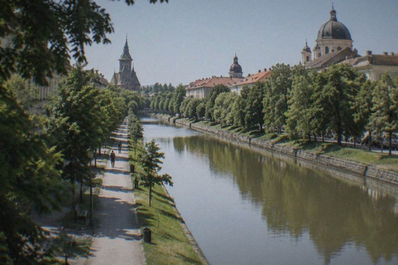
Timisoara lies about 12 km southwest of its Traian Vuia airport, on the Bega canal in western Romania. The historic Cetate district around Piata Unirii and Piata Victoriei holds most sights, with Iosefin, Fabric and Elisabetin ringing it, all walkable or a short tram ride apart.
Timisoara, in Timis County in the Banat region of western Romania, is a city that rewards anyone who takes ten minutes to understand its layout before arriving. The city grew outward from a Habsburg star fortress, so the old core sits tight around the Bega canal while the outer districts, Iosefin, Fabric and Elisabetin, fan off it in a pattern a visitor can grasp from a single glance at a map. This page lays that geography out plainly: where the city sits in Romania, how its districts connect, which landmarks anchor each square, how far the airport is from the center, and how day trips from the city sit on the wider map of the Banat.
Where Is Timisoara On The Map Of Romania?
Timisoara sits in the far west of Romania, in Timis County, roughly 40 km from the Hungarian border and about 75 km from the Serbian border, making it the country's principal gateway city toward Central Europe and the Balkans. It is not in Transylvania, despite a common misconception. The city spreads along the Bega canal at a low altitude, the weather station stands at 86 m, and the nearest big neighbors by road are Arad to the north, Lugoj to the east and Vrsac across the border in Serbia.
Open any map of Romania and find the western edge where the country meets Hungary and Serbia: that corner is the Banat, a historic region shared today between Romania, Serbia and Hungary, and Timisoara is its undisputed capital. Under its Hungarian name, Temesvár, the city was the administrative seat of the region for centuries of Habsburg rule, and under the German name Temeswar it anchored a Swabian farming hinterland. That tri-border position explains two things a first-time visitor notices fast: the city feels Central European in its squares and architecture, and it is unusually easy to add a second country, Serbia or Hungary, to a trip.
The location also shapes arrival planning. Direct trains run from Budapest in about five and a half hours, and the run from Bucharest takes about 11 to 12 hours, so many travelers from outside the region choose to fly instead. Romania is a full Schengen member, with air and sea entry since 31 March 2024 and land borders since 1 January 2025, so crossing from Hungary is now an internal border with no routine checks. The Serbian border remains an external Schengen border with passport control. For full arrival logistics, see flights to Timisoara and the Timisoara airport guide.
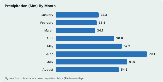
The climate on the map's coordinates is continental, not Mediterranean, whatever a southern-latitude instinct suggests. The JMA/WMO CLIMAT normals for station Timisoara 15247 put January at a mean of 0.0 C and July at 22.8 C, with precipitation running from 34.1 mm in March to 79.1 mm in June, 600.7 mm across the year. June is the wettest month, March the driest. If the timing question matters more than the map question, the best time to visit Timisoara guide breaks the year down month by month.
| Month | Mean temperature (C) | Precipitation (mm) |
|---|---|---|
| January | 0.0 | 37.3 |
| February | 2.1 | 35.5 |
| March | 6.5 | 34.1 |
| April | 12.3 | 50.6 |
| May | 17.3 | 57.2 |
| June | 20.9 | 79.1 |
| July | 22.8 | 61.9 |
| August | 22.5 | 54.6 |
| September | 17.2 | 50.4 |
| October | 11.5 | 50.0 |
| November | 6.4 | 45.3 |
| December | 1.5 | 44.7 |
How Do The Districts Of Timisoara Fit Together On A City Map?
Timisoara's map is organized around four historic districts: Cetate, the old fortress core holding Piata Unirii and Piata Victoriei; Iosefin to the southwest along the Bega; Fabric to the east beyond the old fortress walls; and Elisabetin to the south, a leafy quarter of Secession houses. Everything a first-time visitor wants sits inside or on the edge of Cetate, and the other three districts ring it within easy tram or walking reach. The Bega canal cuts diagonally through the whole arrangement.
The fortress logic still governs the streets. Cetate is the rectangle of the old Habsburg star fortress, its walls demolished from 1899 after the 1892 decision, and its interior is a compact grid of squares: Piata Unirii, Piata Sf. Gheorghe, Piata Libertatii and Piata Victoriei, each a few minutes' walk from the next. Iosefin grew as the suburb toward the south station and holds the Millennium Church and the water tower. Fabric, east, was the workers' and industrial district and carries some of the city's most flamboyant architecture. Elisabetin, south of Cetate, is quieter, residential, and full of the pastel facades photographers chase.
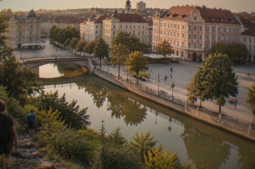
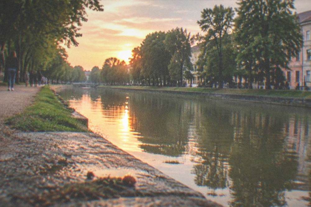
A useful mental trick is to treat the Bega canal as the city's spine. Walking its banks links Iosefin's water tower to the center, and the seasonal vaporetto water bus runs along it from 1 April to the end of October, 9 stops per direction, with a standard 5 lei ticket. The banks have been steadily regenerated, and in May 2026 the city announced works freeing more than 2,000 square meters on Bulevardul Vasile Parvan for park space. For orientation purposes the canal is more useful than any street name: if you know which side of the Bega you are on, you are never lost for long.
| District | Position on the map | Character | Key fixed points |
|---|---|---|---|
| Cetate | Center, inside the old fortress grid | Baroque squares, cafes, main sights | Piata Unirii, Piata Victoriei, Piata Libertatii |
| Iosefin | Southwest, along the Bega | Historic suburb, village-scale streets | Millennium Church, water tower |
| Fabric | East of Cetate | Former industrial quarter, grand facades | Fabric Synagogue, Trajan Square |
| Elisabetin | South of Cetate | Residential, Secession architecture | Piata Maria, quiet residential streets |
Districts are one thing, but the squares are where a visit actually happens, and a guide who knows the ground turns four abstract rectangles into a coherent story.
Which Landmarks Anchor A First-Visit Timisoara Map?
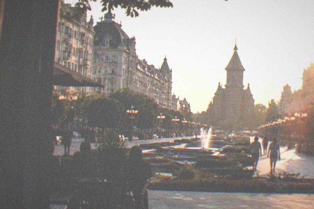
Four landmarks pin a first-visit map of Timisoara in place: Piata Unirii, the Baroque heart of Cetate; Piata Victoriei, where the 1989 Revolution played out in front of the Opera; the Metropolitan Orthodox Cathedral at the south edge of the center; and Theresia Bastion, the surviving fragment of the old fortress. Between them they define the corners of the walkable core, and every other sight in the city can be located relative to one of them.
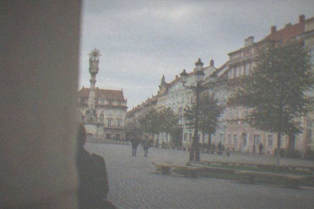
Piata Unirii is the map's center of gravity, a full Baroque ensemble of pastel palaces holding the Art Museum in the Baroque Palace, the Serbian Orthodox Cathedral and the Roman Catholic St George Cathedral on its flanks. From there, one street north leads to Piata Sf. Gheorghe, and beyond it Piata Libertatii, the smallest and calmest of the three squares. Piata Victoriei, the long, straight showpiece between the Opera and the Metropolitan Cathedral, is the axis most photos of the city come from. Theresia Bastion, the restored bastion fragment at the northwest corner of the old fortress, now houses shops, cafes and exhibition spaces, including a new interactive children's museum that opened in May 2026.
Two landmarks need a mental asterisk on the map. Huniade Castle, the city's oldest surviving building, next to the center, has been closed to the public for roughly two decades, and a restoration contract signed in August 2025 targets partial reopening in 2027 and full reopening in 2028, so a visitor in the near term will see it from the outside only. The Memorial of the 1989 Revolution, a short walk east of Piata Victoriei, is open Monday to Friday 08:00 to 17:00 and Saturday to Sunday 10:00 to 18:00, with an adult ticket of 20 lei covering eight permanent and three temporary exhibitions plus a documentary screening. The deeper history behind those December days is covered in the Timisoara 1989 Revolution guide.
| Landmark | Square or district | What the map shows |
|---|---|---|
| Piata Unirii | Cetate | Baroque square, Art Museum, two cathedrals on its edges |
| Piata Victoriei | Cetate, north end | Opera, 1989 Revolution sites, main promenade |
| Metropolitan Orthodox Cathedral | South edge of Cetate | Landmark domes facing Piata Victoriei |
| Theresia Bastion | Northwest corner of old fortress | Restored bastion with shops and museums |
| Huniade Castle | Beside the Bega, central | Oldest building, closed for restoration until 2027-2028 |
| Memorial of the 1989 Revolution | East of Piata Victoriei | Museum of the December 1989 events |
Heritage runs deeper than the big four, and one of the city's quieter mapped threads is its Jewish history, with synagogue buildings in both Cetate and Fabric telling a story the main squares skip past.
If mapping the city yourself feels like homework, a guided option does the plotting for you.
How Far Is Timisoara Airport From The City Center?
Timisoara Traian Vuia International Airport lies about 12 km northeast of the city center, and the express bus line E4, run by the city transport operator STPT, connects the Bastion in the center directly to the airport terminal, alongside a parallel E4B service. A single 60-minute ticket costs 5 lei and is valid on all modes including the water bus, and the same ticket covers the airport run, so the transfer is both simple and cheap by European standards.
The airport is the busiest in western Romania and getting busier: the Romanian Airports Association reported 1,458,098 passengers in 2025, up 10.2 percent from 1,323,690 in 2024, and 2026 brought new routes including Turkish Airlines from Istanbul, Wizz Air from Berlin, Birmingham and Prague, and AnimaWings from Athens. One planning note belongs on any map made before November 2026: the airport announced a full runway closure for essential repairs from 2 to 22 November 2026, so flights in that window need checking with the airline. The step-by-step transfer options are laid out in Timisoara airport to city center, and driving yourself is covered in Timisoara car rental.
| Route | Figure | Source basis |
|---|---|---|
| Airport to center | About 12 km northeast | Official tourism site |
| Express bus to airport | Line E4, Bastion to Aeroport | STPT line page |
| Single 60-minute ticket | 5 lei, all modes | STPT tariff page |
| 1-day pass | 18 lei, all modes incl. vaporetto | STPT tariff page |
| 30-day general pass | 160 lei | STPT tariff page |
| Annual general pass | 1,320 lei | STPT tariff page |
The wider transport map matters too. Trams numbered 1, 2, 4, 5, 6a, 6b, 7, 8 and 9, trolleybuses 11, 14, 15, 16, 17 and 18, express buses E1 to E8 and the vaporetto line V1 make up the network, and real-time arrivals appear at the operator's live site. Contactless bank cards work on board. One live caveat for autumn 2026: Trajan Square works have closed the square to trams from 3 August 2026 until the end of the year, with lines diverted, so a map drawn earlier in the year may not match the tracks on the ground. The full network picture, including the seasonal water bus, is in getting around Timisoara.
What Does An Old Town Walking Map Of Timisoara Cover?
A walking map of Timisoara's Cetate district covers a rectangle barely 1 km on its longest side, linking Piata Unirii, Piata Sf. Gheorghe, Piata Libertatii and Piata Victoriei in a straight north-south chain, with Theresia Bastion at the top and the Metropolitan Cathedral at the bottom. Everything on that chain is flat, sidewalked and walkable in a slow afternoon, which is why the old town works so well for visitors who never open a transit map.
The chain is the point. Start at Theresia Bastion, walk south through the pedestrianized core, and the squares arrive in sequence, each opening unexpectedly after narrow connecting streets. Piata Unirii is the widest and grandest, Piata Libertatii the most intimate, Piata Victoriei the longest and most theatrical. Side detours worth penciling on any hand-drawn map include the Cetate Synagogue, whose restoration was described as nearly complete in December 2025, and the streets toward the Bega, where the park-lined banks give the walk a green finish. Cafes and restaurants cluster thick along the whole route, and the food angle is mapped separately in Timisoara restaurants and Timisoara food.
The scale means a guided walk can cover the whole core comfortably, and the city's list of walking options includes one tour that adds a tram leg to stretch the footprint beyond what feet alone manage comfortably. The full index of guides sits on Timisoara Travel Guide.
For a shorter first pass, the classic option covers the same core squares in a tighter window.
How Do Day Trips From Timisoara Sit On The Wider Banat Map?
Day trips from Timisoara fan out in three directions on the map: north into the Apuseni hills toward Oradea, east into the Transylvanian classics such as Corvin Castle, Sibiu and the Turda Salt Mine, and south into the Banat mountain country, where the Nera Gorge, the Danube gorges and the Banat waterfalls sit within reach of the Serbian border. None of these are city sights, and all of them justify the map-reading effort, because the Banat's scenery is the region's least advertised asset.
The southern arc is the one that tends to get underestimated. The Banat mountains hug the Serbian border and hold the Nera Gorge national park, the Cazanele gorges of the Danube, and the waterfalls around Beusnita, plus the spa town of Baile Herculane. The northern and eastern arcs point at the marquee Transylvanian names, Corvin Castle at Hunedoara and the city of Sibiu, both covered in dedicated guides. The region's broader story, including its villages and the recas wine country, is laid out in the Banat region guide, and the full menu of options appears on things to do in Timisoara.
The city's own visitor numbers show why the wider map matters. Official arrivals grew from 153,794 in 2021 to 283,256 in the 2023 European Capital of Culture year, then 285,190 in 2024, and the city was named Romania's Destination of the Year 2026 at a May 2026 gala. People are coming, and increasingly they are staying long enough to look past the old town.
| Year | Tourist arrivals in Timisoara |
|---|---|
| 2021 | 153,794 |
| 2022 | 212,785 |
| 2023 | 283,256 |
| 2024 | 285,190 |
| 2025 (January to November) | 268,699 |
Which Map Tools Work Best For Getting Around Timisoara?
For getting around Timisoara, the tools that matter are the STPT transit network with its 5 lei single ticket and 18 lei day pass, the live arrivals site for real-time tram and bus positions, the seasonal vaporetto on the Bega from April to October, and the city's color-coded paid parking zones managed by the municipal operator TimPark. A visitor staying in or near Cetate can ignore almost all of this and walk, because the core is flat and compact.
The transit map is simple. Nine tram lines, six trolleybus lines, eight express bus lines and the water bus share one tariff, and one ticket covers a 60-minute transfer window across all of them. Payment is contactless on board, by SMS, by e-wallet or at kiosks. Two planning apps that previously worked with the system were discontinued in 2026, so the operator's own live site is the reliable source for real-time positions. Drivers planning to use a car should note the concentric paid parking zones, highest-priced and shortest-stay in the ultra-central red zone, with enforcement on weekdays roughly from morning to early evening, and payment via the TPark mobile app, SMS or meters.
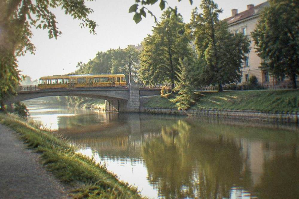
Bicycles fit the map well too, since the core is flat and the Bega banks form continuous car-free stretches; the city's bike-share system is run by the transit operator, though its current fleet size and tariff are not published in verifiable sources, so check the operator's site before planning around it. The practical cycling picture is in the Timisoara bike rental guide on this site. For money questions, the local currency is the Romanian leu, not the euro, and the Romanian currency guide covers it, while budget planning belongs in Timisoara cost and prices.
| Transport element | Figure or fact | Notes |
|---|---|---|
| Tram lines | 1, 2, 4, 5, 6a, 6b, 7, 8, 9 | Trajan Square works diverting lines until end of 2026 |
| Trolleybus lines | 11, 14, 15, 16, 17, 18 | Includes new electric trolleybuses delivered from late 2025 |
| Express bus lines | E1 to E8 | E4 serves the airport |
| Vaporetto | V1, 9 stops per direction | Seasonal, 1 April to end of October, 5 lei |
| Emergency number | 112 | Standard EU number |
Where Should You Stay On The Timisoara Map?
On the Timisoara map, first-time visitors should stay in or immediately around Cetate, the old fortress core, where Piata Unirii and Piata Victoriei put the main sights within a ten-minute walk of most addresses. Iosefin and Elisabetin offer quieter, cheaper rooms a short tram ride out, while Fabric suits travelers who want grand architecture and local life over square-front addresses. The city's hotel stock is expanding, including a Radisson-branded lifestyle hotel that opened in the Baroque old town in June 2026.
The map logic for lodging is simple: the city's attractions cluster so tightly in Cetate that any address inside the old fortress grid eliminates transit from the daily plan entirely. That said, the ring districts are not far, and Elisabetin in particular delivers character at lower rates. New supply is arriving, with the Hotel Galaxy opening on Gheorghe Lazar Street near Union Square in early June 2026 as the first Radisson Individuals property in western Romania, and a Courtyard by Marriott under construction near Iulius Town with opening planned for 2029. The full neighborhood-by-neighborhood breakdown, with price tiers, is in where to stay in Timisoara and best hotels in Timisoara.
What Should A Timisoara Map Include For A One-Day Visit?
A one-day Timisoara map should include, in walkable order: Theresia Bastion at the fortress's northwest corner, Piata Unirii and its two cathedrals, Piata Libertatii, Piata Victoriei with the Opera and the 1989 Revolution sites, the Metropolitan Orthodox Cathedral at the south end, and a Bega canal stretch to finish, with the Memorial of the 1989 Revolution added if museum time allows. That single chain covers the city's essential geography in one flat, linear walk.
The order matters because the squares run in a chain, so a visitor who walks them in sequence never backtracks. Morning light suits Piata Unirii, whose facades face east, and the late afternoon belongs to Piata Victoriei, where the promenade fills and the cafe terraces open. The full sequenced plan, with timings and food stops, is mapped out in the one-day itinerary on this site, and longer versions exist for two days in Timisoara and a weekend in Timisoara.
For travelers whose map extends beyond the city limits, the countryside and gorge options below stretch the same geography into the Banat hills and the Danube's dramatic corridor.
Common Questions About The Timisoara Map
Where is Timisoara on the map?
Timisoara is in western Romania, in Timis County in the Banat region, roughly 40 km from the Hungarian border and about 75 km from Serbia. It is the largest city in western Romania and the region's historic capital.
Is Timisoara in Transylvania?
No. Timisoara is in the Banat, the historic region west of Transylvania. The misconception is common because both regions were under Habsburg rule and share architectural similarities.
How far is Timisoara airport from the city center?
About 12 km northeast of the center. Express bus line E4 runs from the Bastion in the center to the airport, and a standard 5 lei single ticket covers the ride.
What are the main districts on a Timisoara city map?
Cetate, the old fortress core with the main squares, plus the ring districts of Iosefin to the southwest, Fabric to the east and Elisabetin to the south. All are walkable or a short tram ride from Cetate.
Can you walk around Timisoara without a car?
Yes. The Cetate core is a compact, flat rectangle linking four main squares in a chain, and the transit network covers everything beyond walking range with a 5 lei single ticket or 18 lei day pass.
Which countries are close to Timisoara on the map?
Hungary lies about 40 km to the northwest and Serbia about 75 km to the south. Hungary is an internal Schengen border with no routine checks since 1 January 2025; Serbia remains an external Schengen border with passport control.
A map of Timisoara is really a map of one walkable fortress grid with three characterful suburbs attached, and once the four squares and the Bega canal are fixed in mind, the rest of the city arranges itself around them.